

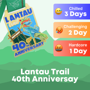


The MacLehose trail is not only Hong Kong’s longest trail, but it was also the only trail in East Asia to be selected as one of twenty “Dream Trails” by National Geographic “Outdoor Luminaries”.
The trail is steeped in history and will take you pass some historic spots such as Lead Mine pass, Smuggler’s Ridge and Gin Drinker’s Line.
Back in the 1980s, it was a part of the Gurkha’s training regimen and they had only 24 hours to complete the entire trail. This then gave rise to the well-known annual fundraiser, Oxfam Trailwalker which welcomed members of the general public to tackle the 100km trail.
Overview
Length: 100 kilometres
Elevation Gain: 5053m Difficulty: 5/5
Recommended Hike Plan
Although the Gurkhas have proved it is possible to complete this trail in 24 hours, we have split this 100km trail up into five days, which can be tackled in succession or over a series of weekends.
The trail has 12 campsites along its route, equipped with toilet facilities and barbecue pits, so if you are hoping to do the whole thing in one go, you can do so knowing that there are camping facilities along the way should you wish to make an overnight pitstop.

Day 1 - 24.1km (7 hours)
Stage 1 - 10.6km (3 hours)
Pak Tam Chung - Long Ke
Markers M000 - L020
You will be glad to know that out of the 10 sections of the MacLehose trail, section 1 is one of the easiest, which is a perfect way to kickstart day 1 of your challenge. You start off in Sai Kung Country Park, along Tai Mong Tsai Road, at the picturesque High Island Reservoir. The route takes you onto High Island itself, before moving onto East Dam, where you will be treated to views of the characteristic hexagonal rock columns of the UNESCO Global Geopark. You then end section 1 at at the beautiful beach of Long Ke, 90m above sea level.
Stage 2 - 13.5km (4 hours)
Long Ke - Pak Tam Au
Markers M020 - M048

There is a steep climb as you leave Long Ke Wan and make your way to Ham Tin Wan, with very little shade, so it is advised you don’t tackle this climb in the height of summer, and to come appropriately dressed, with adequate amounts of water.
The peak offers clears views of the Sai Kung coastline and Sharp Peak, making for a rewarding break. You will be glad to know that there are a few cafes and stores waiting for you at Ham Tin Wan. If you are following our recommended hike plan, it will also be the last stop for day 1, meaning you’ve earned yourself a well-deserved treat and rest on one of Hong Kong’s most spectacular beaches. This beach is also a popular camping spot, and camping gear can be rented from the local stores should you wish to camp overnight.
Day 2 - 22.9km (8 hours)
Stage 3 - 10.2km (3.5 hours)
Pak Tam Au - Kei Ling Ha
Markers M048 - M068
Day 2 kickstarts with one of the most difficult sections of the MacLehose Trail, which requires you to tackle a steep climb up Ngau Yee Shek Shan, taking you 425m above sea level. The undulating mountains and steep gradients of section 3 is what makes this section the most gruelling of all. However, as you make your way up and over these peaks, you get expansive views of Tolo Harbour, Ma On Shan, Three Fathoms Cove and Yim Tin Tsai along the way, making the experience all the more rewarding. As you head down Kei Ling Ha and Sai Sha Road at the end, you will find toilets, water stations and barbecue pits, offering you a chance to refuel or stock up on water before section 4.
Stage 4 - 12.7km (4.5 hours)
Kei Ling Ha - Tai Lo Shan
Markers M068 - M094

Stage 4 will have you walking through Ma On Shan Country Park, and up the steep path of Ma On Shan itself - watch your step here, as there are sharp drops on either sides of this route! You’ll walk along the base of Pyramid Hill before coming out at the Ngong Ping plateau, a hotspot for paragliders, and an official campsite. Regardless of whether you decide to set up camp here or not, this Ngong Ping plateau makes for a great spot to rest and appreciate the views over Sai Kung, and watch the paragliders in action. Bypass the Buffalo Hill and West Buffalo Hill for a short climb towards Gillwell Campsite until you come across an access road, for the end of section 4.
Day 3 - 21.4km (7 hours)
Stage 5 - 10.6km (4 hours)
Tai Lo Shan - Tai Po Road
Markers M094 - M115
Picking up from the Gilwell Campsite access road, head north towards Fei Ngo Shan Road until you come out to Jat’s Incline Viewpoint, where you’ll get rolling views across Hong Kong Island, Victoria Harbour and Kowloon. At the intersection where the MacLehose Trail meets the Wilson Trail, you will get the chance to top up on light refreshments and water at the local store, before entering Lion Rock Country Park. You will have one more final ascent up Beacon Hill, before coming out to a flat section at Eagle’s Nest Nature Trail and coming out at Piper’s Hill Road, and the end of stage 5.
Stage 6 - 4.6km (1 hour)
Tai Po Road - Shing Mun
Markers M115 - M124
Section 6 is one of the shortest and easiest sections of the MacLehose trail. Just be aware that you will be entering monkey territory at the start of this section, as soon as you come off the Tai Po Road footbridge, onto Golden Hill road. History buffs will enjoy this particular section of the MacLehose trail as there are several declared monuments and historical relics from the Battle of Hong Kong along Smuggler’s Ridge and Gin Drinker’s Line, including the Shing Mun Redoubt. As you reach the edge of Shing Mun Reservoir, you will start to make the descent to Shing Mun Road where you will have access to toilets, a water station and barbecue area.
Stage 7 - 6.2km (2 hours)
Shing Mun - Lead Mine Pass
Markers M124 - M137
Once you have crossed the reservoir dam, the trail turns into a dirt path before you are required to make the steep climb up Needle Hill to the summit, standing at 532m above sea level, in no shade. Down the other side of Needle Hill is a long concrete path which is easy to navigate. Just before the summit of Grassy Hill there is a sharp left turn downhill. Although signposted, the path is fairly hidden, so keep your eyes peeled around this area. Towards the end of this section, at Lead Mine Pass, there is an official campsite with toilets and barbecue pits.

Day 4 - 16km (6.5 hours)
Stage 8 - 9.7km (4 hours)
Lead Mine Pass - Route Twisk
Markers M137 - M156
Stage 8 starts with a climb up the fourth tallest peak in Hong Kong, Sze Fong Shan, standing at 785m tall. The path flattens out as you draw closer to the summit, and comes out to a beautiful landscape of large boulders scattered across the mountain pass.
You will then make your way towards Tai Mo Shan, the highest peak in Hong Kong at 957m. Although you won’t be able to access the tallest point, as it is home to the Hong Kong Observatory weather station, you can still enjoy panoramic views of Hong Kong. Just be sure to dress appropriately when tackling this section of the trail, as Tai Mo Shan is the coldest point in Hong Kong, and has been known to get frosty during the winter. You will end this section by the Tai Mo Shan Country Park Visitor Centre, where there is a little kiosk for you to pick up snacks and drinks, with a toilet, campsite site and barbecue pit nearby, for those looking to camp overnight.
Stage 9 - 6.3km (2.5 hours)
Route Twisk - Tin Fu Tsai
Markers M156 - M168
Section 9 starts on the other side of Route Twisk and is a nice gentle walk along a flat, paved concrete service road, which makes for a great cool down after section 8. The path transitions into section 10 seamlessly, after passing Tin Fu Tsai Campsite and is a 1.5 to 2 hour walk to either Sham Tseng or Twist Country Park Management Centre. If you don’t have enough steam to finish section 10 and would rather conserve your energy, we would advise setting up camp at the Tin Fu Tsai campsite, where you will have access to barbecue pits and mobile toilets

Day 5 - 15.6km (5 hours)
Stage 10 - 15.6km (5 hours)
Tin Fu Tsai - Tuen Mun Town
Markers M168 - M200
As mentioned above, depending on where you start from, the start of section 10 can take 1.5 to 2 hours to reach from the road. This final section runs through Tai Lam Country Park, and is the longest of the MacLehose sections, but also considered one of the easier stages. At around marker M174, you will reach Kat Hin Bridge. This area is also a mountain biking trail, so just be careful of riders around this area.
This trail does not follow the Oxfam competition trail, which now ends in Tai Tong, so be mindful of this and be sure to follow your Trail Challenger app closely to avoid taking a wrong turn.

Depending on the season, you may get a glimpse of the Sweet Gum Trees along Tai Tong Nature Trail, which turn red during the cooler months.
Eventually you will come off the concrete and follow a dirt path, the viewing point for Tai Lam Chung Reservoir, also known as Thousand Island reservoir, is a short detour, and worth the views, which are unlike anywhere else in Hong Kong.
When you rejoin the concrete road, you follow the catch water along the contour of the mountain before coming out to the end of the walk at an underpass, which is a short walk to the Tuen Mun MTR station.
Not only have you completed section 10, but you’ve also completed the longest trail in Hong Kong - if that isn’t worthy of a medal, we don’t know what is!
Download the Trail Challenger app and challenge your friends to see who can complete it the fastest! Click here to learn more.